

New England Singletrack on Army Corps Land
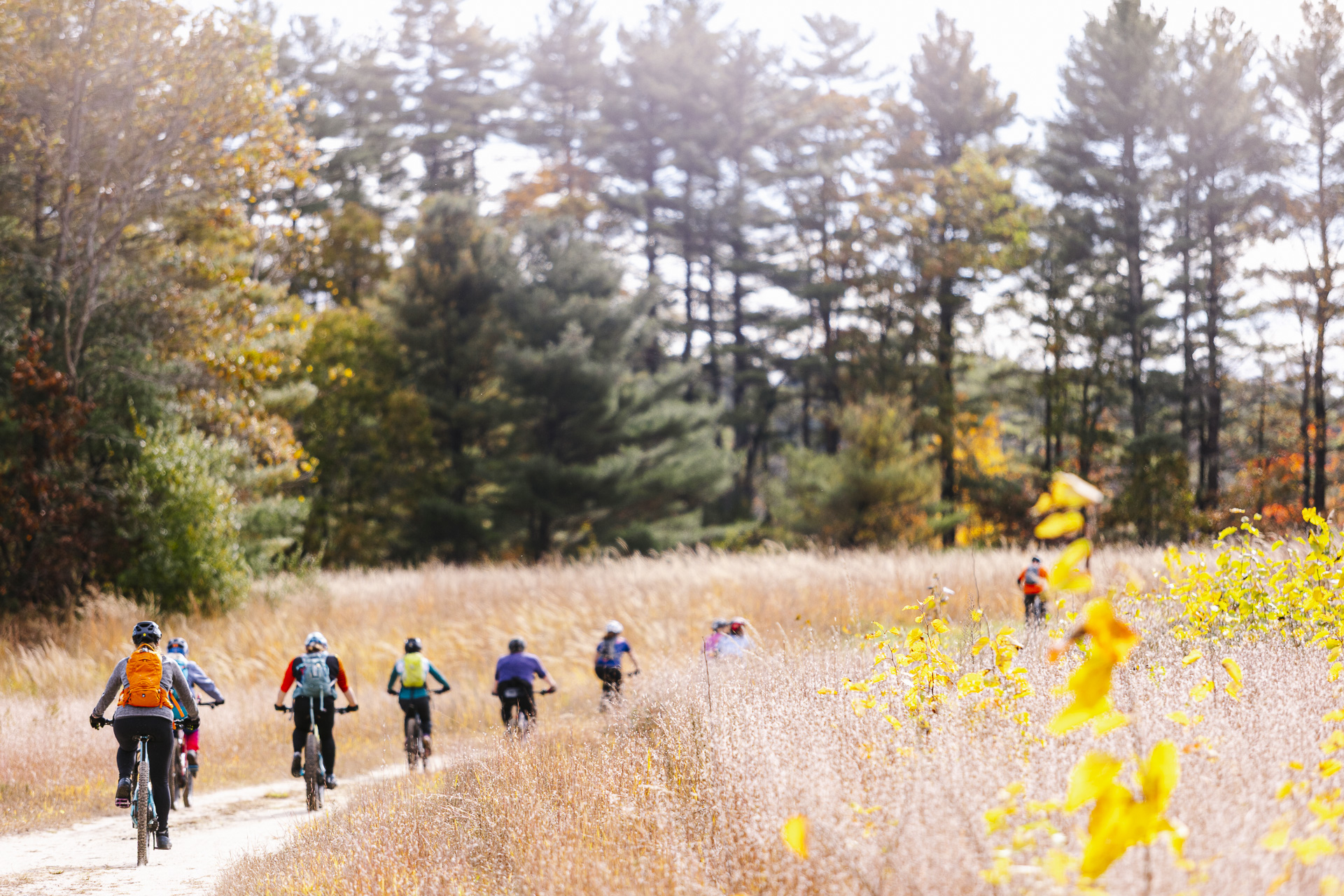
West Hill Dam is the kind of place that surprises you. It is managed by the U.S. Army Corps of Engineers as a flood-control project — but step past the gate and you find 15 miles of honest New England mountain biking: twisty singletrack, rolling doubletrack, and a Skills Park that has turned more than a few hesitant riders into regulars.
The trail system follows the NATO phonetic alphabet from Alpha through Zulu, making navigation intuitive once you learn the layout. Green and Blue ratings dominate, with plenty of B-lines around technical features. It is the right place to build fitness, introduce kids to trail riding, or put in a quick after-work lap without driving an hour.
Land & Stewardship
West Hill Dam Reserve is owned and operated by the U.S. Army Corps of Engineers, New England District. The park stays open year-round — outside posted hours, park at the gate and walk or ride in. Blackstone Valley NEMBA has maintained a strong partnership with the Corps for years, coordinating trail workdays, the annual Best Dam Ride fundraiser, and ongoing improvements to the Skills Park.
All trails are multi-use. Hikers, equestrians, and park rangers share these paths — yield accordingly, keep speeds in check, and say hello.
Skills Park & Pump Track
The Skills Park near the main parking area offers beginner-to-intermediate progression features with B-line options throughout. Loop 1 and Loop 2 provide a low-commitment way to warm up or work on technique before heading into the main trail system. The jump line (WHD Jump Line, rated Blue, downhill only) adds a bit of air for riders ready to step up.
Best Dam Ride
Each fall, West Hill Dam hosts the Best Dam Ride — Blackstone Valley NEMBA's annual flagship fundraiser. The event draws riders of all levels for a scenic mix of singletrack and doubletrack, a vendor village, raffle, and community gathering. All proceeds go directly toward trail maintenance and advocacy across the Blackstone Valley. In 2026, NEYC (New England Youth Cycling) is running the youth program.
Fifteen miles of trail. Zero attitude. West Hill Dam is where the Blackstone Valley rides together.
1 Way In
The Main Parking Lot near the park office is the primary trailhead and the best starting point for most rides.
Recent Trail Reports
Official condition reports pulled live from Trailforks. Always check before you ride — trail status can change quickly after rain or trail work.
Powered by Trailforks.com — official reporters only
Routes
Curated loops to help you get oriented. Route data and elevation profiles via Trailforks.
2025 Best Dam Ride — 14-Mile Course
The signature BVNEMBA fundraiser route — 13.9 miles, 737 ft of climbing, and a mix of singletrack and doubletrack including the newly roughed-in Sierra trail. A strong intermediate ride; all funds raised support trail maintenance at West Hill Dam.
Trail Map
Color-coded by difficulty. Tap any trail to see name, rating, and direction. Full interactive map on Trailforks.
Map data via Trailforks.com. Trail colors: Green Blue Black Double Black
Where to Start
Every trail at West Hill Dam is classified Green or Blue — the system was designed for accessibility from the start. The Green trails follow the early letters of the alphabet and the connector network, giving beginners a logical progression through the woods. B-lines bypass any technical moments you are not ready for yet.
Bravo is the trail that earns its perfect score. At 1.4 miles with 32 feet of climbing and the kind of flow that makes you loop back immediately, it captures everything that makes West Hill Dam worth the drive. High check-in count, high rating — this is the trail regulars bring their friends to first.
View on Trailforks →The Heart of the System
The Blue trails are where most riders spend most of their time at West Hill Dam. Charlie, Oscar, and Papa string together to form the backbone of a full-day ride. These trails have more elevation change, tighter turns, and longer sustained sections than the Greens — but B-lines remain available throughout.
Charlie is the defining trail at West Hill Dam. At nearly three miles with 23 feet of climbing, it threads through the full character of the park — tight hardwood singletrack, open doubletrack connectors, and a handful of features that reward confidence without punishing caution. Link it with Oscar and Papa for a solid half-day loop.
View on Trailforks →Ride Right
Trail data, ratings, and check-in counts sourced from Trailforks. Conditions are community-reported and update in real time. Always check Trailforks before you ride.